Artvin is located on the east of the Black Sea Region, and there is Ardahan on the east and southeast, Erzurum on the south, Rize on the west, Black Sea on the northwest and the Republic of Georgia on the north.
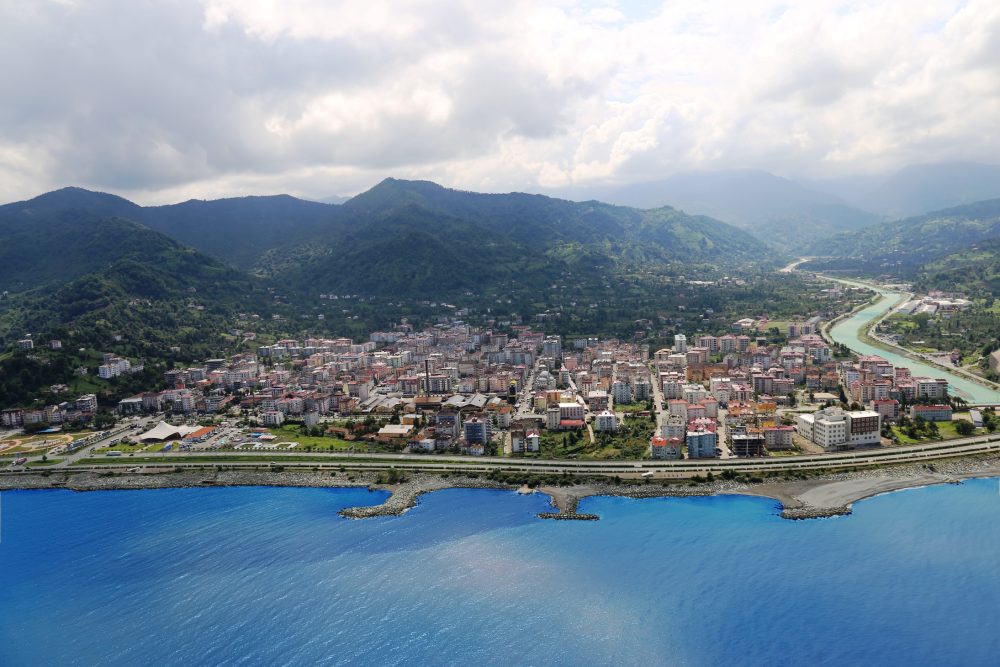
The total area of Artvin is 7,436 sq km and it has 34 km of coastline along the Black sea, and it has 109 km of border-line with the Republic of Georgia. In terms of land structure, Artvin is generally mountainous and in the city there are not savannas with the exception of the plain areas in the coastline of Arhavi and Hopa.Within the borders of the city there are nearly 30 rivers and a number of natural lakes.
EDUCATION
In Artvin during the 2002-2003 educational period in the aggregate of 33,569 students received training and education. The distributions of the schools are: 37 preschool institutions, 174 primary schools, and 26 vocational and normal high schools.
HEALTH
In the city there are 7 state hospitals, 2 social insurance association hospitals, 1 health center, 37 local clinics, 214 health centers and 1 private medical center.
FACULTIES AND COLLEGES
University education is introduced in the faculty of Forestry of Kafkas (Caucasian) University, the vocational Higher School of Artvin, and the Faculty of Education of the Black-See Technical University established recently.
URBANIZATION AND HOUSING
The population increase in Artvin has a high percentage among the other cities in the Black Sea Region.
SOCIAL LIFE AND NON-GOVERNMENTAL ORGANIZATIONS
Turkish traditions and customs are applied authentically as being in Artvin. The people in the region are faithful to their state and have the national unity and cooperation conscious. The religious and national festivals are celebrated in excitement in the city. The interest and participation of the people in region in the cultural activities are high.
WORK LIFE AND SOCIAL SECURITY
When the sectoral distribution of employment is examined during the period of 1980-2000, it is seen that despite there is a continuous diminishing in the employment in the agriculture and industry sectors, the workers in the agriculture sector have the biggest share within total employment. According to the national census in 2000, 61 % of 80,276 workers are working in the agriculture sector.
TRANSPORTATION AND INFRASTRUCUTURE
Transportation network in Artvin is 5,681 km. In Artvin the transportation problem between the population centers is mainly solved. There are 271 km city roads and 273 km state roads network in the city.
MAIN INVESTMENTS
In the provincial area there are 7 projects of dams, which 3 of them are under construction, and 4 are in the stage of contracting, and a HPP project. Five dams, Muratlı, Borçka, Deriner, Artvin and Yusufeli are situated on the Çoruh River, and the other two, Bayram and Bağlık on the branches of the river. The total installed power of dams is 2,084 MW and their average power generation is planned to be 6.3 billions kws/hour per annum. Starting generation of power in these dams will ensure an outstanding contribution to the nationwide power need increasing gradually.
MOUNTAINS
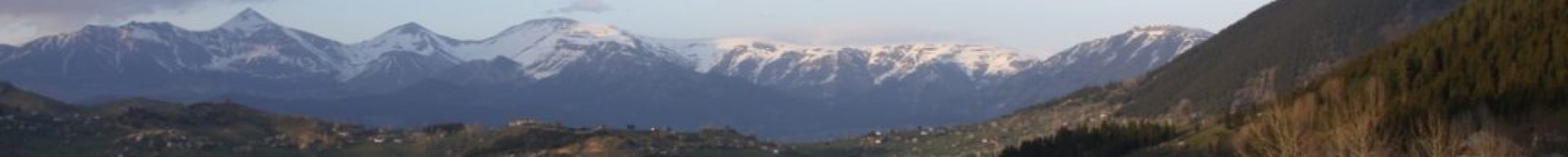
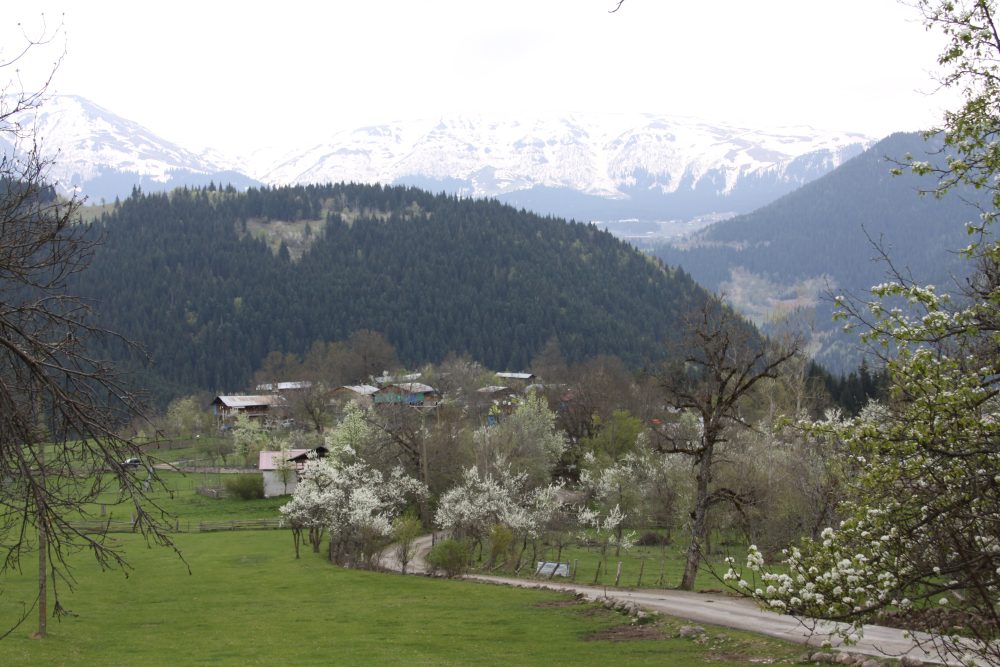
Bulk of the city is covered by the very steep mountains. The more important of them are Kaçkar Mountain on the intersection point of the city borders of Artvin-Rize-Erzurum, Kükürt Dağı located on the city border of Artvin and Rize, Karçal Mountain Chains located on the east of Borçka District, and Yalnızçam and Çadır Mountains located in Ardanuç District.
PLATEAUS
Plateaus cover 51% of provincial lands of Artvin district. Main plateaus are:
Meşeli, Kurudere, Düzenli, Kireçli, Yığılı, Kapik, Irmaklar, Bilbilan (Bülbülan), Çamlıca, Hanlıköy, Ballı, Yoncalı and Sahara Plateaus are located in the region on the southeastern line created by the rooks Yusufeli, Zeytinlik and Ortaköy (Berta).
Manatba, Taşköprü, Meydancık, Zata, İmneza, Mısırlı, Goman, Lekoban, Merete, Oba, Karsnal, Devtopan, Kırkırım Plateaus in the region located between Muratlı (Maradit), – Borçka, Artvin – Ortaköy (Berta) brooks and Georgia.
Keşoğlu, Çamlık, Sevahil, Mağara, İnekli, Durça, Kovahit, Kocakarılı, Dikme ve Taşkınlık Plateaus in the region located in north and northwestern line of Merkez Subprefecture Zeytinlik and Yusufeli.
VALLEYS
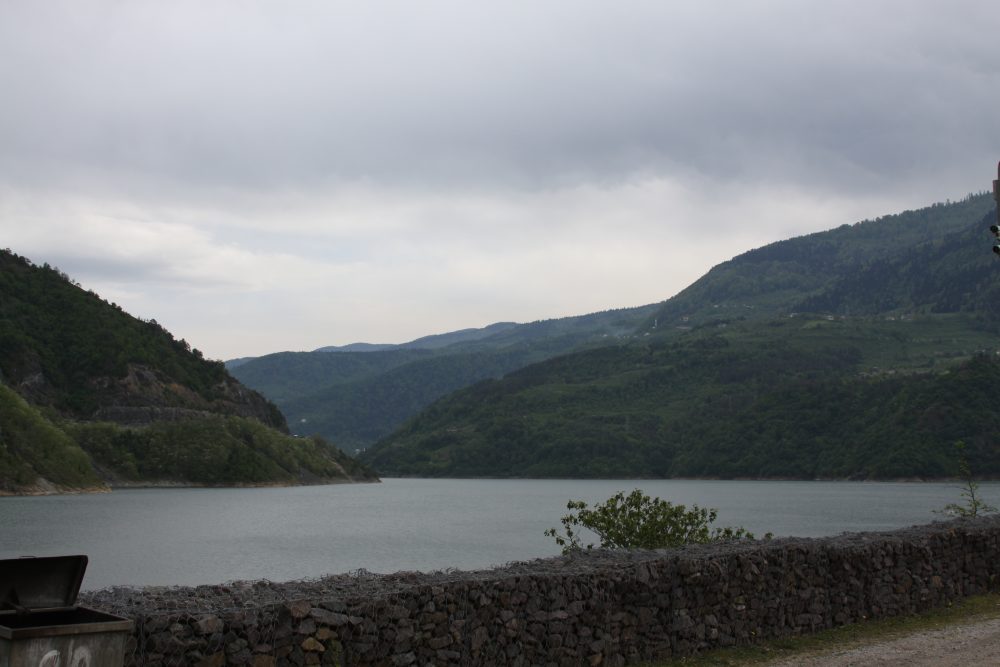
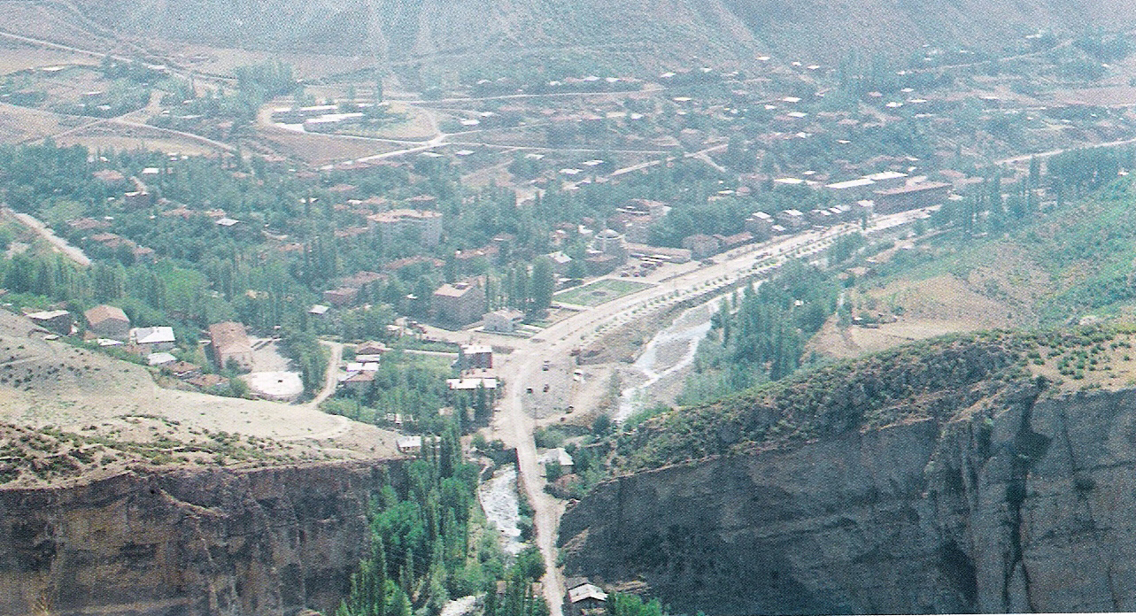
In Artvin narrow and deep valleys were shaped by rivers. The most important valley among them is Çoruh Valley. The length of this valley within the borders of Artvin is 150 km. and this valley has narrow and deep canyons.
ÇORUH BASIN
This Basin is worth to see and it shelters in olive, stone pine and other vegetation that grow in the Mediterranean climate. It has also interesting geographic structure and different climate characteristics.
RIVERS
The longest river in Artvin city is Çoruh River. There are a number of Long and short, large and small rivers, brooks and creeks within provincial lands.
UNDERGROUND RICHNESS
The provincial lands are extended in the district convenient for creation of ore-beds. The richest national copper ore-beds are situated in Artvin.
CLIMATE
The climate in Artvin exhibits diversity because of particulars of earth surface.
VEGETATION
Almost 55 % of the land in Artvin (397.470 hectare) covered by forests.
LAKES
In Artvin there are a lot of large and small lakes. Most of them are formed at the bottoms of glacial valleys and generally called dark lakes. In front of these deep lakes there are moraines heaps. The most important of are the ones located in Şavşat and Borçka, called dark lakes.
HISTORY
Life in Artvin district is dated back to very old times. The ruins in old settlements, tombs, and historical arts found during excavations made for constructions of roads and houses, and for archeological and exploration purposes reveal that Artvin has been a very old place for settlement and mining. it has been determined by the specialists that the copper axes found in Artvin, and Meşeli village of Şavşat subprefecture in 1930, and Demirköy village of Yusufeli in 1955 are dated from Re. 4000-3000; and the bronze ones are from Re. 3000-2000. These arts have been remained from the Hurries age.
Arsakians Period
In 75 A.D., Sembat, leader of Arsakians in Taok district defeated the raiders of Huns and Peçeneks raided to the south of Caucasians. Khazarians and Barsellians coming from the north of Caucasians occupied the area in 182-186 A.D. Borçka, Livana (Yusufeli-Artvin), Acara (Macahel-Acara), Şavşat, Tahoskar/Tavuskar (Şenkaya-Oltu-Ardanuç) were the settlements in the north regional section of the state founded after occupation of Arsakians.
East Rome Period
Later on, upon a “Peace for Eternityıl made by Justiniaus with Iran, the districts of Erzurum and Çoruh, which were the west section of Arsakians, passed to the Byzantium domination.
Islamic Raids Period
Starting from Artvin, Savşat and Ardanuç, all settlements have been occupied by Muslims by means of making peaces. Artvin and its environs were come into Byzantine possession in seven years af ter Muslim occupation. In the second mid of the century VIII, Khazar Turks occupied completely the tribes of Kürs and Arases. Meanwhile, Artvin was added to Kazarians, and were thereafter protected against Arabians.
Ardanuç Bagratians
Adarnase from Bagrat (764-786) who was the provincial leader of Ardahan-Arsiyan-Şavşat-Tayk and Acara entered under the protection of Khazarians. Ahiska and Tayk regions of Ardahan were subject to the Tbilisi-Arabian Emirate connected to the Caliph of Baghdad af ter the establishment of the same Emirate by Harun Reşit in 786 A.D.
Seljuks Period
The raids by Seljukians to inner Anatolia would not come to an end. In 1054 A.D., Tuğrul Bey would siege the Malazgirt Castle of Byzantium while the raiders of his army would raid the Bagratian country up to Bayburt, Barkar Mountains and mid River Çoruh. Alparslan, the Seljukian Sultan who conquered Çıldır from Bagrations, and Ani from Byzantines in June 1064 A.D., punished Bagarat who followed aggressive attitudes by taking Byzantines’ support at his back. In the same year, he added Ardahan, and the next year Ardanuç, Artvin, Borçka, Oltu, Tortum and Yusufeli into his country. Alparslan has allotted the areas he has conquered to his tribes under his domination af ter the Victory of Malazgirt in 1071. So, Çoruh district was given to Ebul Kasım, Emir of Erzurum.
Ottoman Period
At the date when Sultan Mehmet, the Conqueror has terminated The Byzantine-Greek Pontus Kingdom, Yusufeli, Ardanuç, Şavşat and Borçka districts of Artvin were under domination of a tribe of Çıldır Atabeks whose capital was the Kale of Ardanuç. The leaders Imerhev of Şavşat and Acara-Macahel have participated in the Ottoman State following accepting of Muslim religion while they were connected to a tribe of Atabeks.
Ottoman-Russian War of 1877-1878
In 1877, Russians attacked four times to Kars, but they were defeated by Turkish army under the command of Ahmet Paşa, in four open-space fights. Ardanuç Flag was divided into two between the years of 1877 and1917 during nomination of 40-year reign. At that time, all offices and schools except a few mosques and chapels were closed, and all communication was interrupted. The inhabitants have never believed the Russian assimilation, and lost the hope of joining to their home country again.
Independence of Artvin
By means of a diplomatic tone, the Ankara Government would inform to and request from the Georgian Government that the areas under domination of Georgian occupation should be emptied on the one hand, and would give an order to the Command of North Front of Turkish Army that these areas should be occupied even though by force. The date of expiry of that ultimatum was the midnight of February 22, 1921. The actual independence took place on March 7, 1921 when Turkish military unites reached to Artvin.
ECONOMY
Agricultural Production
Despite there are indusrial plants and grain cultivation in the city, now it is becoming widespread to cultivate leguminosae and vegetables. The main agricultural products are: tea, hazelnut, beans, potato, grapes, corn, various fruits and feed plants for animals.
Maritime fishing has an important role in the economy of Arhavi and Hopa as these districts are located on the coastline of Black Sea.
It is necessary to use the areas that appropriate for agriculture with maximum efficiency since there is a shortage of agricultural fields.
Forestry
55 % of area of the province that is equivalent to 397,470 hectare is covered by forest.
DAMS AND EROSION CONTROL PROJECTS
Erosion control and reforestation projects with the purposes to prevent erosion and prolong the lives of dams on the areas where Muratlı, Borçka, Deriner Artvin and Yusufeli dam projects, and also Bayram and Baglik projects starting to be constructed on the side branches of Çoruh River.
The potential erosion area of 31,750 hectares determined in the term of dam basins by means of the project planned to be completed in about 10 years synchronized with the commissioning of the dams which are financed by DSI would have been protected against erosion.
Industry Zones
Including Artvin city center in our city there is not a small indusrty zone in working order. In the investment program of the year 2002 there are Small Industrial Zone projects for constituting industrial zones in Artvin Center, Arhavi and Hopa. The construction activities ain Artvin Center and Hopa are going on.
In our city it is considered important to costitue small industry zones for contributing regional economy. The industrial zones of Artvin, Arhavi, and Hopa which are in the scope of 2002 investment program are planned to be completed in the year 2003.
Commercial Structure
Companies: There are 86 registered corporations in the city and 56 of them stili continue their activities and 532 of the 612 registered limited companies continue their activities.
Banks: Among the city there are 19 branch banks of 5 banks.
Chambers: There are 18 chambers formed by the Chamber of Artvin Craftsmen and Artisans and there are 5.550 registered artisans and eraftsmen. Cooperatives:
In our city there are 13.457 registered members of 164 cooperatives.
Artvin has a 5000year historic accumulation of considerable number of historic arts such as monasteries, chapels, castles, mosques, bridges and mansions, which are the footprints of number of civilizations survived in this region.
Artvin is one of the areas of country where the best samples of wood and stone architecture are come across, local music and dances are admired by everybody who listen and watch, local cuisine culture is rich, and the handicrafts leaded by wooden crafts are produced.
Artvin has a special geographic character with its mountains with different altitudes, natural forests, monument-like trees, glacier lakes and high mountains, canyons, villages and plateaus. Alpinism in Kaçkar, Altıparmak and Karçal Mountains, trekking in natural beauties, rafting in worldwide well-known running water, the Çoruh River and Barhal creek put forward the potential of its aquatic sports.
Festivals organized particularly in July and August in Artvin ensure Artvin Lovers and tourists a 30-40-day uninterrupted entertainment.
Fifty percent of Artvin’s lands are covered with forests. Forests have considerably rich flora and fauna. Numerous endemic species survives within this very rich plant cover. Hunting tourism is also wellknown. Because of its rich running water resources fishing is preferred for particularly salmon trout. Artvin will be expected to be a center of bird-observation viewpoint because it is located on the route of immigrant birds.
One of 300 locations very well protected across the world is in Artvin (MACAHEL). Artvin is in the agenda of world’s public opinion from the ecotourism studies viewpoint developed within the philosophy of protection of nature.
Completion of dams under construction in the Çoruh River would contribute a vision of being a “lakes region” for Artvin. Transportation, one of conditions sine qua non of tourism would be settled in a great extent by entering the Black Sea highway into service
MEDIA IN ARTVİN
As the local radio stations the 08FM and the Borçka FM provide broadcasting in Artvin. In addition, Artvin’in Sesi (Voice of Artvin), Alkan, Demokrat Çoruh, Serhat Artvin newspapers are published in the center of Artvin and Arhavi Postası (Arhavi Post), 7 Mart (7th March) (Borçka), Şavşatın Sesi (Voice of Şavşat), Kafkas Sarp Haber (Caucasus Sarp News) (Hopa) and Doğu Gazetesi (Eastern Newspaper) (Hopa) are published in the districts of Artvin.
HISTORlCAL BUILDINGS
The first ruins reached today in the Artvin lands are the monasteries and castles. Generally they were built in between the V to XI centuries, during the period of Bagratli Kingdom. In the period of Ottoman domination in mid XVI century, mosques, shrines, fountains, bridges, and mansions are main historical arts.
MONASTERIES AND CHURCHES
Starting with Artvin center almost all of subprefectures particularly in Ardanuç, Şavşat and Yusufeli, you can see monasteries built by cut-stone having monumental character. They are very are historical arts within its category reached to today.
Pırnallı (Porta) Monastery: It is in Bağlık, Pırnallı village of Artvin. There is no road for vehicles car way to the monastery and it is composed of a church, Beli Tower, chapel-fountain and other constructions. They were constructed by Bağratlı Kingdom in the 15th century. It reflects best the Middle Age Monastery settlement to our day.
Hamamlı (Dolishane) Monastery Church: It is in Hamamlı village of Artvin. Only its church has survived. It was constructed by the Bagratlı Kingdom at the end of the 9th century. It was used as a mosque after 17th century until 1889. Its proper stone works and vegetal plastic ornaments are interesting.
İşhan Monastery Church and Chapel: It is in Dağyolu viliage of Yusufeli. It was constructed in the 7th century and its original form was constructed by the Bagratlı Kingdom in the ftrst half of 9th century. It was used as the Batı Haç Kolu Mosque for some time. Its proper stone works, plastic embossed designs and fresques are worth seeing. The “Mother Mary Chepel” is located nearby.
Altıparmak (Barhal) Monastery Church: It is in Altıparmak viliage of Yusufeli. It was constructed in the 10th century by the Bagratlı Kingdom on behalf of “Baptist Yayya”. Its plan is basilical and it was turned into a mosque at the end of 17th century and is stili used as a mosque. Its stone work is proper and the building is very sound. Its monumental aura is worth seeing.
Dörtkilise Monastery: It is in Tekkale village of Yusufeli. It is composed of a beli-tower, church, dining hall, seminar room and a chapel. The building group was constructed by Bagratlı Kingdom at the end of 9th century. Its plan resembles that of Altıparmak Church. It reflects the Middle Age monastery pattern very well in the region
CASTLES
Artvin Castle (Livane): It was constructed on a main rock 70m over the Çoruh River across the other side of Artvin Bridge at Erzurum – Samsun Highway. It was constructed by Bagratlı Kingdom in the middle of 10th century and also used by the Ottomans. It has survived tili today and its high tower attracts attention.
Ardanuç (Gevhernik) Castle: It is in Adakale. The construction of the building began B.C. It was used as a ruling place during the Bağratlı Kingdom, Çıldır Atabeks and the Otomans. It is one of the most important casles in the region, and represent the only example of a city structure with its inner castle and city walls. lts remmanants belonging to the previous times and the inscription that belogs to Süleyman the Magnificent, attract attention.
Şavşat (Satel) Castle: It is in Söğütlü quarter of Şavşat. It was constructed by Bagratlı Kingdom in the 9th century and also used by the Ottomans. Today it is abandoned, but, its high castle and most of the city walls are erected.
MOSQUES
Under the frame of Turkish-Islamic culture, the construction of mosques was started in the 16th century. An increase in building of mosque, in which civil architectural tradition was dominant, started at the beginning of the 18th century. The most outstanding structures in which wooden hand made ornaments on the portals, pulpits, walls and ceilings of mosques are very interesting.
Çarşı (Merkez) Mosque. This structure situated in the Centrum of Artvin was built in 1860.
Çayağzı (Salih Bey) Mosque. It is situated in Çayağzı (Korzul) quarter of Centrum was constructed in 1792 by Salih Bey, one of the leaders of Livane tribe.
Zeytinlik Mosque. It is situated village of Artvin Centrum, and was built in 1857 by a Lady Saliha (Saliha Hanım).
İskender Pasha Mosque. It is one of the first mosques of the area, and located in Adakale quarter of Ardanuç subprefecture. It was open for prying in 1553 by İskender Pasha, Senior Leader of Erzurum who conquered the Ardanuç castle in 1551.
Merkez (Çarşı) Mosque. It is situated in the Centrum of Arhavi subprefecture, and was built in 1862.
Ortacalar Merkez Mosque. It is in Ortacalar village of Arhavi subprefecture, and was built in 1757.
Muratlı Merkez Mosque. It is situated in Muratlı village of Borçka subprefecture, and was built in 1846 by an Artisan Mehmet, son of Reşit.
Orta Hopa Mosque. It is known that this mosque, which has no art-of-writing, was built at the end of 16th century.
Erenköy Mosque. It is situated in Erenköy village of Murgul subprefecture, and was built in 1863
Zor Mustafa Bey Mosque. It is situated in Köprülü village of Şavşat subprefecture, and was built in16th century.
Esendal Mosque. It is situated in Esendal village of Yusufeli subprefecture, and was built in 1818 by Muhammad Bey, one of leaders of Kiskin(Yusufeli).
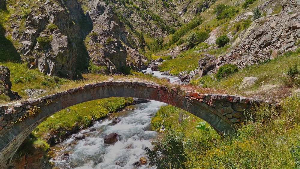
BRIDGES
Berta Bridge: It is on the Şavşat Road in Artvin. It was constructed before 1878 by the Ottomans and its flooring length is 64 m. It has three arches and the surface is smooth. It is still sound today.
Ortacalar Double Bridge: It is at Arılı Küçükköy crossroad 2.5 km to Ortacalar village of Arhavi district. It is composed of two bridges vertical to each other. Both of the have single arch and the road is sloppy and made of stone. They are still sound today.
FOLKLORE
The folkloric games of Artvin are atom, mendo, vazriya, sasa, kobak, düz horon and hemşin, atabari, ucayak, uzundere, sahlan, doney, ahcik, agirbar and cilveloy.
Traditional Woman Wear:
In the past the women would wear dresses called Three Skirts. Upon this a sort of long arm and embroidered waistcoat would be worn. The knee part of the dress was wide and resembled the golf trousers of today. On their waists they would feasten belts and waist clothes (peştemal). Old women would wear fosses whose top part was smoothed, a yazma (a sort of cloth) on it and a leçek (a type of scarf) on that.
Young women would attach golden coins (mahmudiye) on their foreheads.
Traditional Men’s wear
Till the republican times men would wear baggy trousers and broadcloth made of a rough cloth called shawl which was weaved in the looms of the villages. The waists of these shawls, to the sides of which black and dark blue and dark blue silk cords were attached, were tightened. Instead of a jacket, they would wear a long-armed broadcloth which resembled a sort of short jacket with sleeves and this broadcloth had two pockets on two sides of the chest. These pockets were used for bullet cartridges. People who had opportunity had their clothes sewn in the factor. These clothes have caps called “kabalak”.
Traditional Houses
Houses and mansions of 200 to 300 years old from the Ottoman period have different constructor material in each prefecture. Two of them, the Hemşioğulları and the Zor Mustapha Mansions which are called by their owners’ name, are still in good condition.
HANDCRAFTS
The wooden works are very developed in Artvin, which is the land of forests. The wood is used from the wooden architecture to agricultural life and from daily architecture to agricultural life and to the tools and equipment that are used in the daily life. The ehram (pyramid shaped) carpet and rugs are woven as well as the “shawl” weaving in the region.
AREA CUISINE
In Artvin the local tradition of cuisine within Turkish folk culture has been surviving with its full colors. Local names are given below:
Soups: püşürük, çılbır, pancar, çinçar ve lor soups.
Meals made of milk are kuymak, peynir eritmesi.
NATURE TURISM
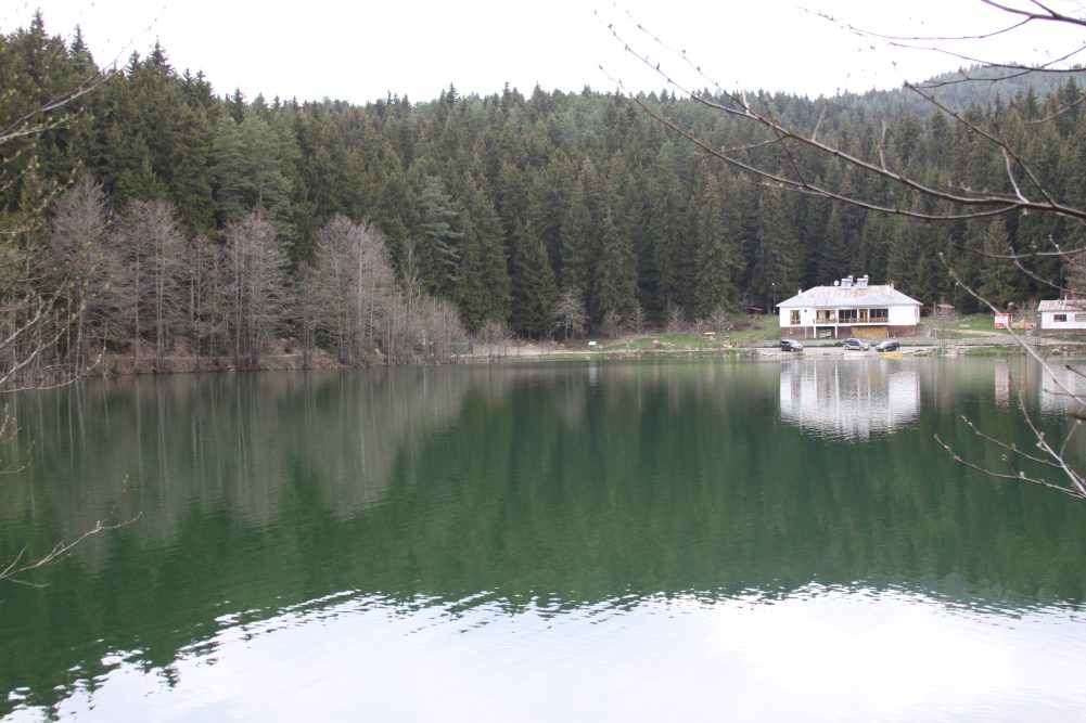
Borçka Karagol (Dark Lake): The lakes are reached by 5 km gravel road that turns from the 22nd km of Borcka-Camili road. There are campsites and parcures for trekking around the lake.
Savsat Karagol (Dark Lake): It is 25 km away from center of Savsat and it is in the borders of Sahara National Park. The environs of lake are covered by dense forests, which are formed by spruce trees and pine trees. Karagol and its environs which are formed by natural elements have unique landscape beauties. It is one of the most proper places for camping and caravan tourism.
HEALTH TOURISM
Artvin region is one of the ideal areas for the health tourism too. The elevations between 800 and 2000 meters are accepted as “healthy climate zone”, and therefore the villages, hamlets and plateaus are established as if this specialty is considered in Artvin.
Camili (Macahel) Basin: From Borçka to the region, transportation is ensured by an asphalt road of 30 km and a gravel road of 20 km. Its forests are such an ecosystem created by monument-like trees almost not touched among the forests not only in Turkey but also Europe. Camili basin has bird-watching areas because of its location is on the migration way of predatory birds. The region attracts attention with its red trout in its creeks, and the “Macahel honey” produced by bees of pure Caucasian race. A part of Camili Basin named as “Gorgit and Efeler Nature Protection Area” is under protection.
Kemalpasa Beach: This beach is one of the best beaches in Artvin that located 15 kms far from Hopa district and it is suitable for camping and caravan tourism with its clear sae and shore nearly 2 kms on Dark Sea.
Sportive Angling: In the rivers and lakes in all parts of the city especially in Barhal brook, Hatila brook, Arhavi Ortacalar brook and Borcka Camili Brook and in the rivers which are located in high places you may angling.
Meydancik (Imerhev): The vicinity of Meydancik is worth to see with its special characteristics. There is an ideal settlement harmonious with the nature, especially Maden Village’s great plateaus, houses completely made of wood and finally with its own culture.
Kackar Mountains: Kackar Mountains indicated by the WWF (World Wildlife Fund) as one of the most important 200 regions which are the privileged protected places of the world, are presented as candidate for a “Pan Park” system. Kackar mountains which have more than 230 bird species, approximately 2300 plant species as 550 of them are endemic and is with natural aged and subtropical forests, glaciers and glacier lakes, natural life, rare ecosystems, overflowing brooks the proper tracking parks which may be easily climbed to 3937 meters high peak presents its visitors the unique natural beauties.
Karcal Mountains: Karcal Mountains is located on the northeast of Artvin and have the deep blue lakes which may be observed during whole year. The forests which have all tones of green, overflowing brooks, the endemic plant species and fauna and have a natural park view; its highest hill is 3652 meters.
PROTECTED AREAS
Hatila Valley National Park: Communication to the valley is ensured by a gravel-road of 10 km far from the provincial center. Both its interesting geological and geomorphologic structures and its original flora give specialty of an area come across rarely in Turkey. Moreover, the unique beauties landscapes arise out as a result of unification of these natural elements, and in this ease a rich recreational potential is introduced.
Sahara-Karagol National Park: Sahara National Park in Karagol, within the district limits of Şavşat includes two separate fields. Sahara is 17 km away from Şavşat district and is located on the Şavşat-Ardahan highway. Its forests are formed by the spruce trees and fir trees. The fields which have the anthropogenic steppe character cover the large areas.
Gorgit-Efeler Nature Protection Areas: Its natural aged forest is one ofits natural old forests which include the trees that each may be a monument and are being very important parameter for the world’s natural protection criteria. It is a rain forest ecosystem with its virgin plant cover which grows up through the deep valleys under the 3200 mm annual rain amount and continuous relative humidity.
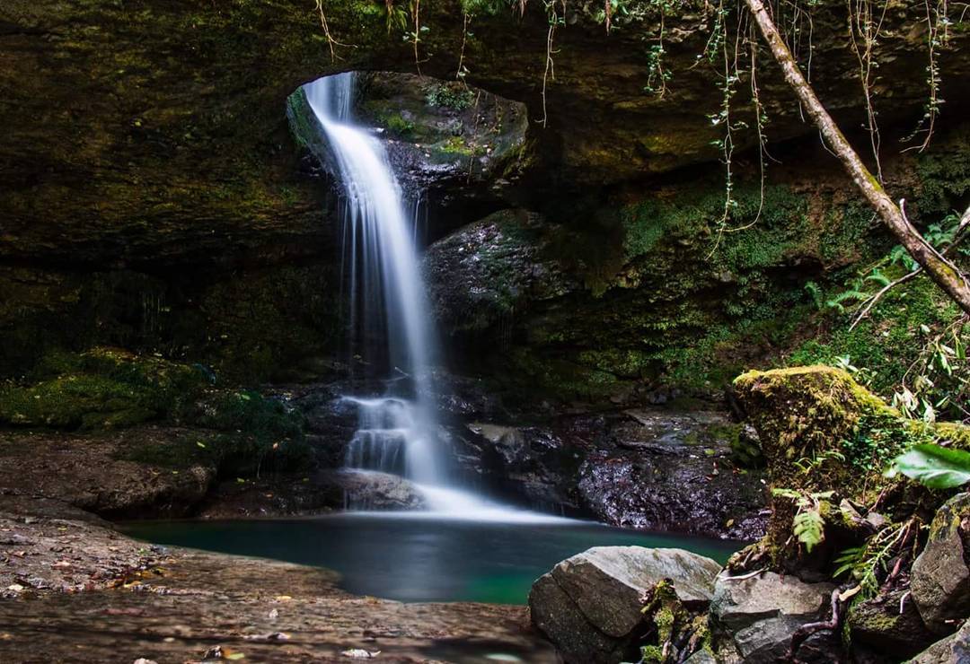
Rafting – Canoe: Çoruh River is one of the fastest running rivers across the world subsequent to the Zambezi and Biabio Rivers. It runs about 260 km, and has 1 to 6-degree of difficulty in 4 different laps for rafting. This region is visited by native and foreign sportsmen and women doing aquatic sports such as rafting, canoeing and river skiing, coming all over the world each year.
Tracking: The best tracks for mountain climbings are located on the highest Kackar range located in Eastern Black Sea region. Alpinist groups who came to the region finishes their Trans-Kackar tracking by walking from Yusufeli Yaylalar village to Rize – Camlihemsin – Ayder high plateaus. Besides, there are suitable tracks for alpinists on Altiparmak and Karchal Mountains, there are pensions and campgrounds for visitors to stay.
Nature Tracking with Horse- There are ideal areas for the “nature tracking with horse” in the plateaus which are at the skirts of Kaçkar and Karçal Mountains in Savsat, Ardanuc and Yusufeli villages.
Plateau Tourism: There are beautiful samples of wooden and stone architectures on the plateau which are widespread in Artvin. The Artvin plateaus, spread over the greenish plains on the forest covered mountains and which the overflowing rivers pass. As the tent/camp areas are available on those entire plateaus, the pensions are available on some of them.
Camp and Caravan Tourism: There are proper places for the camp and caravan tourism on the beaches, resting place in the forest, in the national parks and some of them are Kemalpasa Beach and its environs, Kafkasor Inner Forest Resting Place, Borcka Karagol, Savsat Karagol, Sahara Plateau, Yusufeli Kackar Tourism Center and Yusufeli Cevreli Village rafting camp center.
Bird and Butterfly Observation: The high hills of Hopa, Murgul, Borcka and Artvin are on the migration way of passage birds. So they are suitable places for bird fanciers to observe birds between March and November. Artvin and its districts are really great places with their rich flora and fauna for butterfly fancies.
Jeep Safari Tourism: Artvin has proper areas and courses for those who are interested in the jeep safari with its unique natural beauties.
Eco Tourism: Recently, when the studies on protecting tej cultural and natural resources are popular in the world, Artvin is being important with its perfectly protected nature. Camili (Macahel) Basin is assested within the project on Biologic Variety and Management of Matural Resources – GEF II, which is financed by the World Bank and executed by the Ministry of Forest and Environment of Turkey. It is one of the 4 points in the scope of project in Turkey and its being within the borders of Artvin.
Wild Life: The races such as bear, chamois, boar, wolf, fox, jackal, partridge, quail and trout are some of wildlife in Artvin where 55% of its land covered by forests.
PHOTOS FROM ARTVIN